(Updated December 25, 2017 to include Hull Lifesaving Museum; February 27, 2018 to include several short hikes to ruins; and June 16, 2018 to include independent bookstores and a map shop. June 2023 note: a lot of inflation has happened since this was produced. Please let me know if you have significant price updates to report.
BSU Geography professors Domingo and Hayes-Bohanan spend a lot of time together as they travel with EarthView. During a particularly long drive recently (returning from a special program near Washington, D.C.), Dr. Domingo made an interesting suggestion: Our geography students should never be bored, and dating them should always be interesting.
The conversation continued, and the result is this map of places for GeoBears to take their dates -- or simply to visit with friends.
Why go to the mall or "hang out" aimlessly when we have so many places in our region where we can learn about the world? Plan a date around any of the places on this map, and interesting conversation is guaranteed. Use this map in combination with Dr. Hayes-Boh's blog and map of coffee shops to find interesting places (that is to say, not Dunkin') for a coffee or meal as part of the date.
We are fortunate that Bridgewater is situated in the middle of such a diverse region, with an extraordinary variety of ways to learn about physical, human, and historical geography. We offer just a few here. When visiting any of these sites, be sure to explore the neighborhoods that surround them as well. The majority of these sites shown here can be reached within an hour's drive of our campus, but we have included a few that are a bit farther out. Geography is about exploration, after all!
Figures in RED next to the names of attractions below are basic admission fees as of June 2015. If two fees are shown, the first is general adults and the second is college students with ID. Other discounts such as AAA, seniors, or military may apply and can be found on individual web sites. Please notify Dr. Hayes-Bohanan if you notice a price change. Massachusetts State Parks and the National Park Service have annual passes that may be worthwhile for frequent users -- particularly of state parklands.
The Mapparium ($6 / $4) is conveniently located near the Prudential Center in Back Bay. It is the most essential place for a geography date in the entire region. It is a 30-foot, stained-glass globe based on the political boundaries and place names current in 1936. For an admission of $4 to $6 each, you can enter the globe and learn a lot of geography. An annual visit is warranted! It is located in the Mary Baker Eddy Library, which serves as a sort of museum for the Christian Science Church, one of several religious movements that started in New England in the 19th century, and as part of the Christian Science Monitor, one of the country's best news organizations. Inside the museum is a very nice cafe serving fair-trade coffee and tea with a variety of healthy light fare.

While in the area, geographers can take a short ride on the T or a nice walk if the weather is good to the Leventhal Map Center ($0) at the Boston Public Library, one of the world's great map collections. It is free and open to the public.
 |
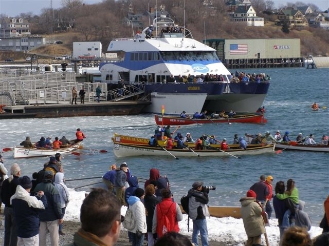
Snow Row is for rowers and observers.
Get on the water, or watch from the lounge
aboard the ferry.
Next race: March 3, 2018 |
The
Hull Lifesaving Museum ($5) is a great introduction to the maritime heritage of our region. It commemorates the important lifesaving service that is one of the precursors to the modern Coast Guard. The museum includes fascinating examples of equipment used to rescue people from shipwrecks, including boats and other devices invented specifically for use in Hull.
Because many of the heroic rescues were conducted with the use of specialized rowboats, the museum is a leader in preserving the culture of maritime rowing in New England, and hosts a number of rowing events at its nearby boat house. One of these is the annual Snow Row (named for a Mr. Snow, but also sometimes featuring snowfall), in which Dr. Hayes-Bohanan sometimes participates. The museum itself is located near Nantasket Beach, views of Boston Harbor, shops and restaurants to make a complete day trip. Use the
Point Allerton station web page to plan your visit, as hours are seasonal (Feb-Aug).
Plimoth Plantation ($25.95) is a place to learn about the early history of the United States, and is an interesting historic site in its own right, being the first educational facility of its kind. Located a few miles south of the modern center of Plymouth, it is a re-creation of the original village staffed by actors who take their representation of seventeenth-century attitudes and daily life very seriously. This approach has been replicated in Williamsburg, Sturbridge, and elsewhere, but Plimoth remains particularly compelling. Outside the model English settlement is a Wampanoag settlement in which local indigenous actors challenge common notions about the early meeting of two societies.
Plymouth Waterfront & Mayflower II ($12)
The waterfront is still worth a visit! The location of the Mayflower's is home to a replica of the original ship and a replica of the original rock. The ship is actually more realistic than the rock, which was brought to the site hundreds of years after the fact. Nonetheless, an elaborate little temple surrounds it. The Plymouth waterfront and the nearby Main Street area at the top of a bluff are among the most pleasant walking areas in this region, and is home to many excellent restaurants and coffee shops. The waterfront is free, of course, as is looking at the ship from the shoreline.
Whaling, thankfully, is no longer practiced by the United States or most countries, but it was for many years the most important economic activity in several parts of our region. The historical geography of that industry -- including its influences on migration up to the present day -- are explored from a variety of perspectives at the New Bedford Whaling Museum ($14 / $9) and New Bedford Whaling National Historic Park ($0). Both of these are an easy drive from Bridgewater, and are surrounded by excellent dining and shopping.
The Whaling Museum ($20 / $18) in Nantucket requires a bit more time to visit, but can be reached in a well-planned day trip, which Dr. Hayes-Bohanan demonstrated with his Frameworks class in 2014, in which students developed lesson plans related to Nantucket's most notorious whaling disaster..
Cape Cod National Seashore ($20 / vehicle) is worth visiting any time of year, as this part of the outer Cape has an ever-changing personality. It is a bit of a drive from Bridgewater, but can be enjoyed in a long day trip. Outside of the summer season, lodging in the area is less expensive, and camping is also possible.
Adams National Historic Park ($10) Three homes occupied by two early U.S. presidents are within a few blocks of the city of Quincy. Given the parking and traffic problems that would be created by people trying to drive to these homes, the National Park Service has created an elegant solution. All visits to the homes begins at the NPS office in the city center. Geographers visiting the park can practice something that all geographers should learn to do: whenever possible, go high for a look around. In this case, the top deck of the parking garage behind the office provides a wonderful place to survey the southern edge of metro Boston, as well as planes approaching Logan. The tour itself provides many insights into many aspects of pre-colonial and colonial geography. The restaurants of Quincy feature cuisines from across the globe, so the meal following the park visit can be a geography lesson of its own.
Paper House ($2) This is a small, inexpensive, and fascinating attraction that is a nice side trip from other destinations in Salem. While in the area, you can dine at the geographically-named Latitude 43 on the waterfront, and admire its wooden bar, which was crafted by Dr. Domingo's son.
The Peabody Essex Museum (PEM) ($18 / $10) in Salem is such a treasure that geographers living in Massachusetts really should visit at least once each year. Salem is best known, of course, for a brutal period of religious intolerance known as the witch trials (though of course no witches were involved), and a visit to the city should include the memorial and museum.
But even more important to the geography of our entire region is the maritime history of Salem, which was once among the world's busiest and most important harbors. The permanent collection at PEM includes magnificent models and artifacts related to the shipping itself, including an extensive collection of maidenheads. The museum also includes many items brought from the regions with which Salem captains traded, particularly in China. Most remarkable is a relatively new exhibit -- an entire, two-story house, more than century old, that was brought to PEM from China. In addition to these extraordinary permanent exhibits, the library hosts several special exhibitions each year, including some of the best you are ever likely to see.
Salem is home to many excellent places to eat. For coffee and tea, the best is Jaho, a few blocks from the PEM. Salem also has a great vexillological treasure at the historic Hawthorne Hotel, where a BSU (then BSC) contingent stayed during a NESTVAL meeting a few years back. Every day, the hotel staff change the flags at the main entrance to include the flag of a different U.S. state on one side of the door and the flag of a different country on the other. The hotel restaurant is excellent for atmosphere.
Rebecca Nurse Homestead ($7) Although the monuments and museums of the Salem witch trials are in the center of the city of Salem, the events of 1692-1693 took place in an inland area of Salem that is now in the town of Danvers. It is there that one can still visit the home of the first victim of the trials, who was also an ancestor of Dr. Hayes-Bohanan's wife and daughter. In May 2015, the homestead was used to film the pilot of The Devil You Know for HBO. It was also the set used for an authentic retelling of the trials story in Three Sovereigns for Sarah.
Walden Pond State Reservation ($8 / vehicle) Henry David Thoreau is among the nineteenth century's most important writers in several fields, including natural history and political philosophy. His work continues to inform the field of environmental geography through his own works such as Walden and through such works as Thoreau's Country, which is required reading in our department's class on Land Protection. The pond and surrounding woods remain a quiet oasis in the suburban sprawl west of Boston, and remain an excellent place for deep contemplation, despite the many visitors who come to walk or swim in the place Thoreau made famous..
Waterfire Providence ($0) began in the late 1990s, initially as a way to celebrate First Night. The immense popularity of the event ensured that it would be repeated, typically a couple dozen times each year. Starting just before sunset, floating fire pits full of recovered wood -- mainly from the removal of old piers and wharves -- are set alight throughout the river and turning basin in downtown Providence. Under every bridge, an elaborate sound system plays the music selected with a particular theme for the evening. As the fires burn until late evening, street performers, food trucks, and other attractions draw thousands of people into a downtown area that was once considered a no-go zone. It is good to visit the waterfront at any time, but especially during Waterfire evenings. See the web site for a schedule and guidance on parking. Comfortable shoes are advised, because it is easy to end up walking several miles during these events.
A greenway is a recreation and wildlife corridor that connects existing areas of open space. In the greater Boston area, a greenway connecting the North Shore to the South Shore in a path roughly paralleling I-495 has been a goal for decades. It is gradually coming to fruition, and the Nunckatessett Greenway ($0) is the local section. A new rail trail in West Bridgewater is easily accessible and is considered a "spur" to the main trail. Check the Nunckatessett web site for the latest information on access to trails for walks long or short.
Purgatory Chasm ($5 / vehicle) Is an excellent day trip with moderately challenging trails through some geologically fascinating terrain. A visit to Purgatory Chasm is also a lesson in microclimates, as small differences in aspect and elevation can make some areas inaccessible because of snow and ice while others are sunny and dry.
Boston Harbor Islands ($17)
Admission to this combined National Recreation Area and state park is free, but it can only be reached by passenger ferry, for which round-trip tickets are $17. The islands are very close to Boston and can be accessed from the city or from South Shore towns Hingham and Hull. Possibilities include the arts, history, or urban wilderness, and opportunities are greatest during the summer. Planning is a bit complicated, as some islands are reachable from different ports than others. Fortunately, web sites operated by National Park Service, the Boston Harbor Islands, and Boston Harbor Cruises provide detailed information on where to go, what to look for, when, and how. Search these pages for the explanation of a geographic oddity of this park. The size of this park changes hour by hour, more than doubling during a single day before returning to a smaller size. How?
Fuller Craft Museum ($10 / $5)
This museum is a treasure just a few minutes drive from campus, on the southwest side of Brockton. It features an intriguing permanent collection and fascinating exhibits that change throughout the year. It is a great place to spend an hour or two exploring artworks from the region and from around the world. It has an excellent gift shop as well.
Coffeeland World Gifts Espresso Cafe (varies)
Our department is known for its connections to coffee in general through the annual
coffee travel course in Nicaragua and through the annual
coffee-tasting event that is open to the public. The seminar that hosts that tasting also requires students to visit and
blog about coffee shops throughout the region and beyond, and many of the finds have been remarkable. Just beyond the westernmost point of I-495 -- about where the apple orchards begin to dominate the landscape -- is the most remarkable coffee shop of all.
Featuring fair-trade, organic coffee from Dean's Beans, this cafe is also an excellent example of social entrepreneurship, providing employment for people with disabilities in the Clinton area and a fair-trade market place for people who produce craft items throughout the world. It is a project of the Polus Center for Social and Economic Development, which is directed by a Bridgewater State College graduate and which started some of the projects we visit in Nicaragua. The cafe does many of the things that the
Benjamin Linder Cafe that students proposed for BSU would have done. A short walk from the cafe are two other good date destinations -- the
Museum of Russian Icons ($10 / $5) and the
Gallery of African Art ($0). An afternoon spent in Clinton can provide quite a slice of global education, plus a slice of pie!
Borderland State Park ($5 / vehicle) is on the border between the nearby towns of Sharon and Easton. The former farmland offers lake views, fishing, and miles of easy-to-moderate walking trails. It is an especially good place to walk with dogs!
Oliver Mill Park ($0) is just a few miles south of the BSU campus. In the spring it is a great place to watch the annual herring run, as these anadromous fish move upstream to spawn. Throughout the year it is a nice place to relax and explore the ruins of what was once America's most important shovel factory.
Cable Car Cinema ($9.75 / $8.25) is a great place to see independent and foreign films that might not make it to the nearest multiplex, and is ideal for dates because many of the seats are actually small sofas (love seats). It is also a place to have excellent coffee, either at the cafe tables in front or in the theater itself. The whole place is also a bit of a geography lesson, having been the machine house for a cable car that connected Brown University (at the top of a hill) to the lower waterfront area. With a little planning, a date here can be combined with WaterFire Providence.
Battleship Cove ($17)
Fall River is no longer the naval center it once was, but it is still a good place to learn about life aboard naval vessels, particularly in the World War II period. Several different kinds of ships are berthed together in this cove, with excellent interpretive signage and a small museum. It is in a neighborhood with many other interesting things to see, do, hear, and taste. Time your visit right, and you can enjoy live music at The Narrows afterward.
Cape Cod Canal ($0) is one of the world's most important canals -- a human construction that essentially turned the peninsula of Cape Cod into an island. It is worth a visit just to enjoy the views from various overlooks along Routes 6 and 6A on either side, or to take a long walk or bike ride along the canal. It is also worth going to both visitor's centers -- one at near the center of the canal along Route 6 and the other at the far northeast end of the canal on the 6A side. This is an excellent date activity because of the variety of things to notice, from the engineering of the canal itself to the geography that makes it so important and lessons about modern navigation -- all in a splendidly beautiful location. At least two graduates of our department have been employed by the Army Corps of Engineers as civilian rangers at the canal.
Cape Cod Central Rail ($22 and up -- way up)
This is among the pricier outings on this page, but should really be considered for special occasions. The train connect Bourne to Barnstable, crossing the Cape Cod Canal using its "third" bridge. The route includes open spaces that are difficult to access by car, as well as unusual glimpses of neighborhoods from the backyard -- something geographers can really appreciate. The "way up" prices refer to various dinners, brunches, and beverage tastings.
If you go: Note that trips may start in Barnstable or Bourne -- make sure you choose the right station for your event!
 |
The Hayes-Bohs don't just talk about visiting local sites.
This image appears in the New York Times article about our dating. |
Cape Cod Canal Cruises ($15 to $20)
HyLine Cruises offers another great way to view the areas surrounding the Cape Cod Canal -- from a boat. Prices vary by season and by length and type of excursion. It is sometimes possible to watch a train cross the canal on the very unusual drawbridge that makes an at-grade crossing compatible with the passage of tall ships.
Walkway Over the Hudson ($0)
We understand that Poughkeepsie is not in day-trip range of Bridgewater, but this is such a remarkable example of applied geography that we have to include it here.
 |
| The entire Hayes-Boh family enjoying the view from high above the Hudson. We usually do not take photos standing in front of landmarks, but photographer/geographer Jeff Anzevino (who has occasionally been a guest speaker at BSU) insisted. And since he helped to create this bridge, we could not resist! |
Visionary people in the mid-Hudson region saw the potential in a hulking, abandoned railroad bridge, and turned it into a remarkable way to knit together the entire region. As described in
Under the Skywalk, this transformation involved a lot of partners, set some world partners, and continues to yield great results. Plus it looks really cool.
Our video project of the Walkway Over The Hudson State Historic Park.
Posted by First Flight Photography on Monday, June 8, 2015
Lizzie Borden Bed and Breakfast ($15 / $12.50 -- day tours; overnight significantly more)
This could be just a daytime date or an overnight stay! The house in which two murders took place for which Lizzie Borden was tried -- and acquitted -- over a century ago now operates as an inn overnight while offering tours by day. It is also the location of the final exam in Dr. Hayes-Boh's class Geography Frameworks, which was studying the case during the spring 2015 semester.
 |
| Dr. Hayes-Boh standing in (so to speak) for Mrs. Borden during a house tour. |
Old Colony History Museum ($2 to $4)
Learn about the cultural and economic history of Taunton, aka Silver City.
Five Hikes to Ruins (varies, mostly free)
The blogger Sophia of
Only in Your State provides a listicle in which she describes
five trails that lead to ruins throughout Massachusetts. Three are in the Holyoke area and two in the Boston area: Eyrie House, Dinosaur Footprints, Becket Quarry, Greycourt, and Bears Cages. A good day trip could combine two or three of these with other sites on the GeoDates map.
Ward Maps
While adding independent book stores to the GeoDates map, I decided I should include at least one map store. I used to visit a nice shop in Cambridge that sold mostly new maps. It closed, but there remains a vintage map store that is probably even more interesting. This is one GeoDate I need to make for myself soon!
Independent Bookstores ($0 to $∞)
Independent bookstores are, as we all know, increasingly rare. As much as we enjoy the convenience of online shopping, when my family buys books, we get them from independent sellers as often as possible. They remain a great place to learn about new books, either by browsing or by talking to the employees who are there mainly because they love books. (Speaking of dates, my favorite librarian did not even know she was going to be a librarian when she worked at the B. Dalton Book Sellers in Security Square Mall in Catonsville. I was pleasantly surprised to find her behind the counter there one evening, a few months after we had broken up. See our
New York Times article to find out what happened after that.)
A BSU student recently shared a listicle about independent book stores throughout New England. I think I have been to just two of those stores so far, but the list seemed to be very worthy of inclusion on this map. See
Best Independent Bookstores in New England to read the list and commentaries by by journalist (and bookstore co-owner) Joe Bills. Locations and links to store web sites are included on the GeoDates map itself.